Photos of rising water around Eagle Lake
Published 3:05 pm Sunday, February 24, 2019
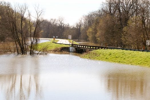
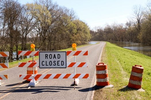
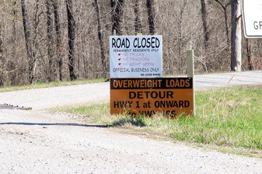
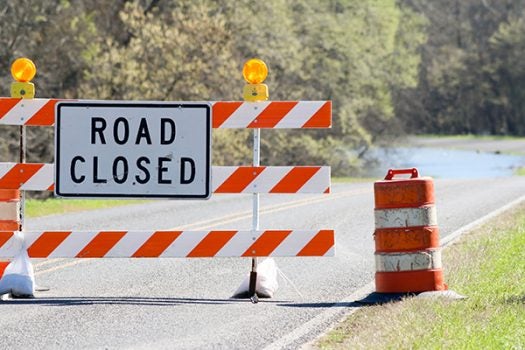
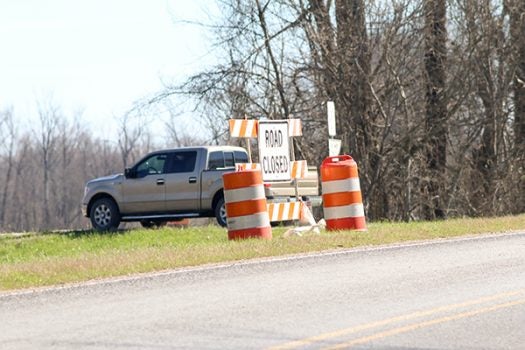
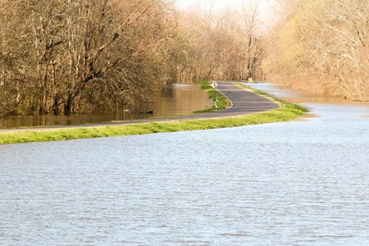
Photographer Water Frazier took these photos of the rising water around the Eagle Lake community Sunday. The photos are of the Yazoo River Levee that runs parallel to Highway 465. The “Road Closed” sign pictures are at Highway 465 about half-way between U.S. 61 and Eagle Lake where the levee intersects Highway 465.
The Mississippi Department of Transportation closed Highway 465 Saturday evening due to the rising flood waters. Only Eagle Lake residents in light passenger vehicles will be allowed to use the Yazoo Backwater Levee from U.S. 61 to Highway 465. Heavy trucks and equipment will have to drive to Highway 1 near Onward to get back to Highway 465 and access Eagle Lake from the north along the Mainline Mississippi River Levee.
Sheriff Martin Pace strongly encourages people who do not need to be in the area to refrain from being sightseers.
More News


SportsPlus
How to Watch Top 25 Women’s College Basketball Games – Monday, December 9
Only a single top-25 game is on Monday’s college basketball schedule. That contest is the Queens (NC) Royals…
Top 25 College Hoops Picks Against the Spread – Monday, December 9
Only one top-25 game is on Monday’s college basketball schedule. That matchup is the Abilene Christian Wildcats squaring…
Best Bets for NCAA Basketball Picks Against the Spread for Monday, December 9
The college basketball slate on Monday is sure to please. Our computer model has suggested picks against the…
How to Watch Top 25 College Basketball Games – Monday, December 9
Ranked squads will be on Monday’s college basketball schedule in one game, the Abilene Christian Wildcats playing the…
How to Watch the NBA Today, December 9
The New York Knicks and Toronto Raptors will take the court in the only contest on the NBA…
-
Polls
 Loading ...
-
-